
There's no single number that applies nationwide. A quote depends on acreage, site access, state and local rules, the consultant's experience, and what deliverables you actually need. A 2-acre suburban lot and a 200-acre agricultural parcel with three wetland types don't get the same price tag, and they shouldn't.
This article breaks down realistic U.S. pricing ranges, what drives the cost up or down, and the questions you should ask before signing a proposal.
Key Takeaways
- Small, accessible parcels often cost far less than large or heavily regulated sites; acreage is only one cost driver.
- Quotes may bundle or separate desktop screening, fieldwork, reporting, agency coordination, and permitting.
- Difficult access, complex wetland systems, and off-season timing can raise fees as much as size does.
- The lowest bid can cost more later if it skips fieldwork, revisions, or agency follow-up.
How Much Does a Wetland Delineation Cost? (Pricing Overview)
Wetland delineation pricing varies because the term covers several different services. A desktop screen reviews existing maps and databases to flag the possibility of wetlands.
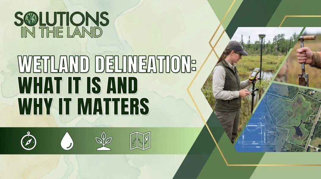
A full delineation involves boots-on-the-ground fieldwork, boundary flagging, GPS mapping, and a report built to withstand agency review. These are not interchangeable products, and confusing them is where most budgeting mistakes start.
Based on published 2023-2025 industry examples, here's a rough sense of what U.S. landowners have paid:
| Service type | Illustrative range | Source and notes |
|---|---|---|
| Desktop screen (non-agricultural land) | $1,050 | A3 Environmental, 2023 pricing example |
| Desktop screen (agricultural land) | $2,050 | A3 Environmental, 2023 pricing example |
| Small residential site (1-5 acres) | $1,500-$3,000 | Swamp School, 2025 educational estimate |
| Medium site (5-20 acres) | $3,000-$7,000 | Swamp School, 2025 educational estimate |
| Standard project, Illinois example | $3,500-$8,000+ | A3 Environmental, published May 2023 |

These figures are illustrative examples from specific consultants and specific years — not a national pricing standard. Geography, site conditions, and what's actually included in the quote will move these numbers up or down.
What's typically included versus excluded:
- Desktop research and existing database review (usually included in a screen)
- On-site vegetation, soil, and hydrology observations (fieldwork only)
- Boundary flagging and GPS/GIS mapping (fieldwork only)
- Written report with data forms and photographs (often billed separately)
- Agency submission, permitting, or mitigation planning (almost always separate)
Screen, Reconnaissance, or Full Delineation: Know Which One You Need
These terms get used loosely, but they mean different things:
- A wetland determination or screen checks whether wetlands may be present using existing maps (no boundary walk required).
- Reconnaissance is a general site assessment that can confirm absence or roughly locate a resource, without precise flagging.
- A delineation physically identifies and maps wetland boundaries on the ground.
- A jurisdictional determination (JD) is an agency decision about whether those wetlands fall under federal regulation.
- A delineation report is the documentation package submitted for agency review.
- A permit application is a separate request to authorize a proposed activity, which may reference the delineation but isn't the same service.
An inexpensive screen might be perfect for early site selection. It typically won't satisfy a permitting authority that requires a full, flagged, documented delineation.
Why Cost-Per-Acre Comparisons Can Mislead
A 2-acre site and a 50-acre site don't scale linearly in price. Travel, mobilization, project setup, and report writing are largely fixed costs.
A tiny parcel can end up costing more per acre than a larger one simply because the consultant still has to drive out, set up equipment, and write a full report regardless of size.
Key Factors That Affect Cost and What the Fee Includes
A proposal reflects professional time, field effort, data interpretation, and regulatory risk — not just how many acres you own.
Property Size, Layout, and Access
Acreage matters, but so does parcel shape, the number of separate wetland areas, and how easy the site is to reach. Remote parcels, dense vegetation, standing water, or the need for specialized access equipment all add field hours. A property with one contiguous wetland area is faster to delineate than one with five scattered pockets, even at the same total acreage.
Site Conditions and Technical Complexity
Multiple wetland types, adjacent streams, floodplain features, or disturbed land can require more sample points and more professional judgment calls. Consultants base their fieldwork on vegetation, hydric soils, and hydrology indicators, following the 1987 Corps of Engineers Wetland Delineation Manual and the applicable regional supplement for that area. Sites with conflicting desktop data, where aerial imagery and ground conditions disagree, often need a return visit and a higher fee.
Deliverables, Reporting, and Regulatory Scope
Not every project needs the same paperwork. Common deliverable tiers include:
- Basic findings letter — presence/absence confirmation with minimal documentation
- Mapped delineation — flagged boundaries with GPS coordinates
- Formal report — methodology, data sheets, photos, and professional sign-off
- Jurisdictional determination support — help requesting an agency ruling
- Permit and mitigation documentation — added when wetlands will be impacted
Confirm in writing whether agency coordination, revisions, meetings, or responses to comments are included in the base fee or billed as extras. That scope gap is one of the most common reasons two proposals look similar until invoices arrive.
Season, Timing, Travel, and Consultant Qualifications
Vegetation-based indicators typically need to be observed during the growing season, so an off-season visit can trigger a return trip and extra cost. Travel distance, hourly versus flat-fee billing, and the consultant's experience level also shape the quote.
Federal, state, and local rules are not identical. Confirm current requirements with the relevant agency before you compare fees.
Cost Breakdown by Project Stage
- Desktop review: maps, databases, soil surveys, and aerial imagery — sometimes billed alone, sometimes credited toward full delineation
- Field investigation: site walk, sample points, flagging, and GPS mapping — larger or complex sites may need more crew or visits
- Report preparation: methodology, data forms, photos, maps, limitations, and professional sign-off
- Permitting and mitigation: filing fees, agency coordination, and mitigation planning — almost always priced separately
Low-Cost vs High-Cost Wetland Delineation — How to Estimate the Right Budget
The right budget matches what the project actually requires. Site size, wetland complexity, access, and deliverables drive cost more than whether a quote looks low or high on paper.
Lower-cost project profile:
- Small, accessible parcel with clear boundaries
- One or few wetland areas, minimal streams or floodplain overlap
- Limited fieldwork and a focused, single-purpose report
- No anticipated agency pushback or mitigation needs
Higher-cost project profile:
- Large or remote site with restricted access
- Multiple wetland types, streams, or floodplain features
- Extensive mapping and multi-agency coordination
- Likely permitting and mitigation work due to expected impacts
Before requesting quotes, work through a short budgeting checklist:
- Parcel acreage and intended land use
- Project footprint and suspected wetland or stream features
- Required submission format (screen, report, JD request)
- Timing constraints and growing-season availability
- Site access conditions and travel distance
- Possible follow-up visits or revisions
Request itemized proposals from qualified professionals, and compare scope, deliverables, exclusions, schedule, revision policy, and billing method, not just the headline number. A $2,000 quote that excludes the report you need isn't cheaper than a $3,500 quote that includes it.

Once the environmental picture is clear, many landowners and agricultural stakeholders need planning beyond the delineation itself. That often includes farm business planning, lease structuring around conservation areas, or long-term land use strategy.
Solutions in the Land works with farmland owners and operators on this kind of site-specific planning after environmental constraints are understood, though it isn't a wetland delineation provider itself.
What Most People Miss When It Comes to Wetland Delineation Cost
Focusing only on the field visit is the most common budgeting mistake. Desktop research, data analysis, report writing, and professional review can take as much time as the site walk itself, and they're often priced separately.
Before approving a proposal, confirm whether it covers:
- Streams and buffer zones, not just wetlands
- Floodplain features and additional wetland types
- Agency correspondence and revision requests
- Permit support, if impacts are anticipated
An incomplete or agency-unacceptable report doesn't just cost you the original fee. It can trigger a refresh, repeat fieldwork, redesign, project delays, or unplanned mitigation costs.
Questions worth asking before you sign anything:
- What methodology will be used, and which regional supplement applies?
- What is the final deliverable: a letter, a map, or a full report?
- How many field visits are included in the price?
- What assumptions were made that could change the price later?
- Which expenses are reimbursable (travel, mileage, printing)?
- What happens if site conditions differ from the initial desktop review?
Conclusion
Wetland delineation cost depends on site size, conditions, scope, regulatory requirements, travel, timing, and the professional effort each project demands. There's no shortcut around that variability.
The right budget covers the documentation your project actually needs, not the cheapest number on a page. Before you request quotes:
- Define your intended land use
- Gather the property information you already have
- Ask for a written, itemized estimate from a qualified wetland professional
An itemized estimate prevents most of the cost surprises landowners run into later.
Frequently Asked Questions
How much does a wetland delineation cost in Florida?
Florida consultant rates are rarely posted as fixed prices, so request a written quote. Chapter 62-340, F.A.C. methodology, site acreage, and permitting scope drive the final cost, and government petition fees stay separate from consultant fees.
How long is a wetland delineation report good for?
Validity depends on the reviewing agency. A Corps-approved jurisdictional determination is typically valid for five years, and Florida's state formal determination binds for no more than five years if site conditions haven't changed. Confirm current rules with the agency reviewing your project.
What is included in the cost of a wetland delineation?
Costs typically break down into desktop review, fieldwork, sampling, boundary mapping, and report preparation, with agency coordination often priced as a separate service. Confirm inclusions and exclusions in writing before approving any proposal.
Do I need a wetland delineation before building?
If wetlands or other regulated waters could be present on or near your project site, most permitting authorities require a delineation before construction begins. Check with the relevant local, state, or federal permitting authority and a qualified wetland professional early in planning.
Can I perform a wetland delineation myself?
Desktop maps and aerial photos can help with early screening, but a formal delineation requires current technical methods, field expertise, and defensible documentation agencies will accept. Confirm your reviewing agency's requirements before relying on self-performed work.